← Back to The HUT

August 1983 · Vol. 19 No. 8

August 1983 Magazine (Vol. 19 No. 8)

Issue first-page cover

Magazine · 16 pages

August 1983 Magazine (Vol. 19 No. 8)

Captured text — scan page 1

Automatically captured text may contain recognition errors. Compare it with the original scan.

This shows the complete scan page, including any other material on it.

HUT!

Se

Minnesota Canoe Association (Ke August 1983 / Volume 19, Number 8

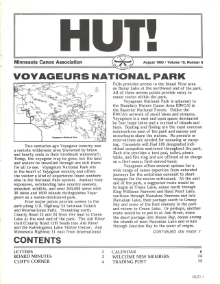
YO! AGEs NATIONAL PARK

Falls provides access to the Island View area

on Rainy Lake at the northwest end of the park.
All of these aecess points provide entry to
canoe routes within the park.

Voyageurs National Park is adjacent to
the Boundary Waters Canoe Area (BWCA) in
the Superior National Forest. Unlike the
BWCA's network of small lakes and streams,
Voyageurs is a vast and open space dominated
by four large lakes and a myriad of islands and
bays. Boating and fishing are the most common
summertime uses of the park and canoes and
motorboats share the waters. No permits or
reservations are needed for canoeing or camp-
ing. Canoeists will find 100 designated indi-
vidual campsites scattered throughout the park.
Each site provides a tent pad, toilet, picnic
table, and fire ring and are offered at no charge
on a first-come, first-served basis.

Voyageurs offers several options for a
wide range of canoe expertise from extended
journeys for the ambitious canoeist to short
voyages for the novice enthusiast. At the east
end of the park, a suggested route would be
to begin at Crane Lake, canoe north through
King Williams Narrows and Sand Point Lake,
continue through Namakan Narrows and into
Namakan Lake, then portage south to Grassy
Bay and some of the best scenery in the park
and International Falls. Travelling north, and return to Crane Lake. Or perhaps, another

County Road 23 and 24 from Orr lead to Crane route would be to put in at Ash River, make
Lake at the east end of the park. The Ash River _ the short portage into Moose Bay, canoe among
trail (County Road 129) heads into Ash River the islands of west Namakan Lake and return
and the Kabetogama Lake Visitor Center. And through Junction Bay to the point of origin.

Two centuries ago Voyageur country was
a remote wilderness area traversed by brave
and hearty souls in their birchbark watercraft.
Today, the voyageur may be gone, but the land
and waters he travelled through are still there
for all to see. Voyageurs National Park sits
in the heart of Voyageur country and offers
the visitor a kind of experience found nowhere
else in the National Park system. Ancient rock
exposures, outstanding lake country scenery,
abundant wildlife, and over 200,000 acres with
30 lakes and 1600 islands distinguishes Voya-
geurs as a water-dominated park.

Four major points provide access to the
park along U.S. Highway 53 between Duluth

Minnesota Highway 11 east from International CONTINUED ON PAGE 7
LETTERS 2 CALENDAR 8
BOARD MINUTES 3 WELCOME NEW MEMBERS 14
CLIFF’S CORNER 4 TRADING POST 15

HUT! 1
Articles (7) · Summaries (7)

Generated issue overview: August 1983 issue of HUT!, the monthly newsletter of the Minnesota Canoe Association. It includes canoeing features and trip reports, association and chapter news, board minutes, a calendar, member letters, and other newsletter material and advertisements.

Generated summaries are descriptions, not original captured text. Page-range text shows complete scan pages and may include neighboring material.

Voyageurs National Park

Title transcribed from original publication

Generated summary: A guide to canoeing in Voyageurs National Park describes its lake-and-island landscape, access points, campsites, suggested routes, and safety precautions. The article continues from page 1 on page 7 and identifies Meyer as a park naturalist.

Open scan page 1

Read captured pages 1–7 →

ARE EQUIPMENTOHOLICS GRODY TO THE MAX?

Title transcribed from original publication

Generated summary: In a letter responding to a previous HUT! commentary, the authors welcome paddlers with different equipment and argue that sharing knowledge and enjoying canoeing and companionship matter more than gear or speed.

Open scan page 2

Read captured pages 2–3 →

CLIFF’S CORNER

Title transcribed from original publication

Generated summary: A humorous account of a spring canoe run on an unnamed Pine County river recounts difficult muddy access, a mishap involving a stranded driver, and challenging rapids that damaged one canoe. The author describes the day and the river as memorable.

Open scan page 4

Read captured page 4 →

LONG DISTANCE CANOE RACERS

Title transcribed from original publication

Generated summary: A racing report covers the Jensen Handicap, including its unusually close finishes, and the Snow Lake race in Manitoba, describing the event, community hospitality, race conditions, and results across men's, women's, and mixed teams.

Open scan page 10

Read captured page 10 →

TWIN PORTS CHAPTER NEWS

Title transcribed from original publication

Generated summary: A chapter report describes newly elected officers, a committee considering MCA affiliation, and a slide presentation about a canoe trip in the Northwest Territories. It also lists upcoming chapter meetings, a cruise, and a whitewater class.

Open scan page 11

Read captured page 11 →

CRUISIN’ ALONG

Title transcribed from original publication

Generated summary: A safety note warns that unusually high river levels can make familiar canoe routes hazardous, using strong currents and waves below locks on the Mississippi as an example. It advises paddlers to check conditions before a trip.

Open scan page 12

Read captured page 12 →

THE CROW WING RIVER CRUISE, JUNE 4, 5, 1983

Title transcribed from original publication

Generated summary: A trip report recounts a two-day Crow Wing River outing, including wildlife sightings, a detour to Mud Lake, camping, low-water rapids, and a vehicle recovery after two participants became stuck in sand during the shuttle.

Open scan page 13

Read captured page 13 →