Articles (8) · Summaries (8)
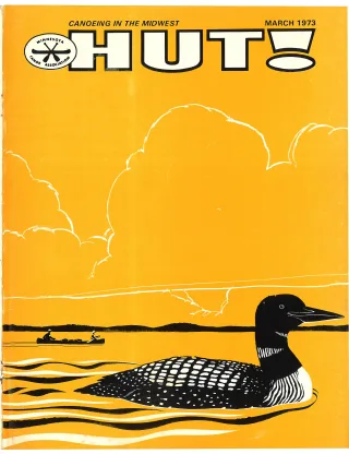
Generated issue overview: March 1973 issue of HUT!, the Minnesota Canoe Association magazine. The issue includes canoe trip and whitewater features, loon research, conservation coverage of Boundary Waters water quality and mineral rights, race information, a cruise schedule, association listings, and advertisements.
Generated summaries are descriptions, not original captured text. Page-range text shows complete scan pages and may include neighboring material.
Wanted: 1000
Title transcribed from original publication
Generated summary: An appeal for increased MCA membership, volunteer involvement, outstate meetings, and participation in association activities. It also discusses the benefits of membership and a planned March member event.
Open scan page 3
Read captured page 3 →
Seek the Wild Wolf
Title transcribed from original publication
Generated summary: A guide to paddling sections of Wisconsin’s Wolf River, describing rapids, access points, camping, water levels, and suggested trips. It includes a river map and a table of route distances and rapid difficulty ratings.
Open scan page 4
Read captured pages 4–7 →
Whitewater Instruction
Title transcribed from original publication
Generated summary: A photographic feature showing activity and reactions at Thursday-night and Sunday kayak and canoe classes.
Open scan page 8
Read captured page 8 →
Gavia Immer — The Common Loon
Title transcribed from original publication
Generated summary: An overview of common loon calls, migration, nesting, reproduction, habitat, and social behavior, drawing on the author’s research. It asks canoeists to contribute observations through the Project Loon Watch questionnaire.
Open scan page 10
Read captured pages 10–11 →
Deliverance on the North Platte — Or It Didn’t Even Seem Like a Good Idea Then.
Title transcribed from original publication
Generated summary: A humorous account of an inexperienced canoeist’s frightening first encounter with whitewater on the North Platte, told through the misadventures of the narrator and his companion Murphy.
Open scan page 12
Read captured pages 12–14 →
Mythical Long Distance Racing Trophy To Be Awarded in 1973
Title transcribed from original publication
Generated summary: An explanation of the MCA long-distance canoe racing points system, eligibility, race difficulty factors, and awards for the 1973 season, accompanied by results from the prior season.
Open scan page 14
Read captured page 14 →
Can We Keep Our Canoe Waters Clear?
Title transcribed from original publication
Generated summary: A discussion of recreational impacts on Boundary Waters Canoe Area water quality, including campsite erosion, waste, outboard motors, coliform bacteria, and nutrient inputs. It reports comparisons between heavily used and lightly used lake areas and warns that continued use can affect water quality.
Open scan page 15
Read captured page 15 →
The BWCA Mineral Rights Problem
Title transcribed from original publication
Generated summary: An account of the history and legal dispute over mineral rights and exploration in the Boundary Waters Canoe Area. It describes the lawsuit, Judge Neville’s ruling and injunction against mineral activity, and a request for contributions to the BWCA Defense Fund.
Open scan page 16
Read captured pages 16–18 →