← Back to The HUT

January 1973 · Volume/issue not printed or unknown

January 1973 Magazine

Issue first-page cover

Magazine · 20 pages

January 1973 Magazine

Captured text — scan page 8

Automatically captured text may contain recognition errors. Compare it with the original scan.

two-thirds through the Chute and so far I
have not dared to attempt it, though I
have heard it has been run.

Two and three fourths miles below the
Chute on the left bank is the last portage,
three fourths miles to Crane Lake around
the “Gorge”. It’s a tough climb up :and
steeper down.

The rapids look like they could be run
without undue difficulty; however, the
vertical walls of the Gorge pose a rescue
problem in case of an upset. So far, I have
always portaged because I have been ina
small group and didn’t have proper safety
equipment (helmet and wet suit). If you
portage, it is worthwile to paddle back to
the river where there is a semblance of a
trail on the east bank, climb the rocks,
and peek over the rock rim at the river
sixty feet below. It is no place for sma
children.

To the left from the portage is the-site
of one of the oldest fur trading posts which
dates from 1736.

The canoeist has now completed the
The Rice Beds trip to Crane Lake and may pull out at any
of a number of private and public land-

gaits fave F i i he trip east into the

below Buyck. A short way up isabig pool This is warning to crowd to the left bank 8S Or continue t 3 os
below rapids, a good place to fish. Pelican and be on the lookout for the portage B.W.C.A. or Quetico fa aM Weal 201%
River offers a worthwhile trip,too,through around High Falls. The river is only a Voyageur’s National Park. In traversing
lovely, isolated country. If only there jump across at High Falls but please don’t the Vermilion River, he has had a glimpse.
was time enough! try to find out. of all the beautiful and varied aspects of
Chipmunk Rapids, two miles below the US.F.S. Road #203 crosses the river the Laurentian Shield Country with some
Pelican, can be run without difficulty. It one fourth mile below the Falls. The Su- Personal insight of the impact of its prod-
requires crossing from left to right about perior National Forest provides a picnic UCts on the history of the people and liv-

halfway down. area and parking for access to the river. iNg creatures of the area.
One mile below Chipmunk Rapids, the Camping is not permitted.
Vermilion spur of the Virginia Rainy Just below the bridge, the river nar-

Lakes Logging Company crossed the river rows to the “Chute”. Upstream from the

in 1920. The bridge ruins are stillin place. white water at high stages, the current is

One and one half miles downstream, the incredibly fast and extreme care must be
pilings in the river date from the logging taken in approaching the portage (on the

days. Pine logs from upstream were driven left bank). There is a tricky rock about

this far, trapped by boom logs, and hoist-

ed to railroad cars for transport to the

company’s sawmill at Virginia, Minnesota. :

This was the largest pine sawmill in the Big Falls
Lake States. It drew its logs from this
general aréa from 1910 to 1929.

About one mile from the pilings is
Snowshoe Narrows where pine covered
bedrock on both banks constrict the
river. The right bank is a good campsite.
Three and one half miles below Snowshoe
Narrows is another good campsite at the
base of a high, pine covered hill. This
marks the beginning of the “rice beds”
which extend for the next eight miles. It
is a beautiful sight in late August, after
the grain has turned gold against the dark
green big pines that line much of the
shores. There are several eagle nests in
these pines. The Gold Mine Resort is lo-
cated in the rice bed area. It is the only
resort on the river. A gold mine operated
here for many years. It is said, however,
that the stockholders provided more gold
than the ore that was mined.

Two and one half miles past the resort,
at the end of the rice beds, is a rocky is-
land with a campsite at the upper end.

6 HUT! JANUARY 1973
Articles (10) · Summaries (10)

Generated issue overview: January 1973 issue of HUT!, the Minnesota Canoe Association magazine. It includes canoeing and river-trip articles, canoe-building guidance, a Minnesota geology feature, cross-country ski racing coverage, and the association’s position on the Boundary Waters Canoe Area. The issue also describes a new monthly MCA Newsletter and HUT!’s move to an every-other-month schedule.

Generated summaries are descriptions, not original captured text. Page-range text shows complete scan pages and may include neighboring material.

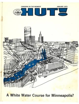
A Canoe Course For Minneapolis

Title transcribed from original publication

Generated summary: Proposes a whitewater canoe course in downtown Minneapolis, linking a suggested fountain project and riverfront redevelopment with opportunities for canoeists to design a course on the Saint Anthony Falls gradient.

Open scan page 4

Read captured page 4 →

Canoeing The Vermilion River

Title transcribed from original publication

Generated summary: Describes the Vermilion River route from Lake Vermilion to Crane Lake, including its rapids and falls, hazards, portages, campsites, access points, and historical and natural features.

Open scan page 6

Read captured pages 6–8 →

A Caution On MCA Resin

Title transcribed from original publication

Generated summary: Explains potential effects of exposure to canoe-building resin and styrene, and offers precautions for ventilation, skin and eye contact, clothing, and safe handling.

Open scan page 9

Read captured page 9 →

AWA Establishes Manmade Slalom Course Committee

Title transcribed from original publication

Generated summary: Reports the American Whitewater Affiliation’s appointment of A. R. McLain to chair a committee evaluating possible manmade slalom-course sites and working with local groups on course development.

Open scan page 9

Read captured page 9 →

The Story of Our Minnesota Earth

Title transcribed from original publication

Generated summary: Explains how glaciers and streams shaped Minnesota’s landscape, discussing lakes, moraines, eskers, Lake Agassiz, waterfalls, potholes, and ancient rocks, with examples from state parks.

Open scan page 10

Read captured pages 10–12 →

X-C Ski Racing For National Championships

Title transcribed from original publication

Generated summary: Previews the U.S. Ski Association Nordic National Championships at Hyland Lake Park Reserve in Bloomington, covering the event, course, racing and touring equipment, and ways spectators and recreational skiers can participate.

Open scan page 12

Read captured pages 12–13 →

Builders’ Contest

Title transcribed from original publication

Generated summary: A photo feature on the 1972 canoe builders’ contest, showing and captioning winning canoes and construction details. The printed credit identifies Ketter for the photographs.

Open scan page 14

Read captured pages 14–15 →

Kayaking the Grand Canyon

Title transcribed from original publication

Generated summary: Recounts a supported kayak trip down the Colorado River through the Grand Canyon, describing rapids, kayaking techniques and hazards, equipment, safety constraints, and the experience of the trip.

Open scan page 16

Read captured pages 16–17 →

Canoe Building and Weight Considerations

Title transcribed from original publication

Generated summary: Offers construction suggestions for reducing the weight of wood-strip canoes, including wood selection, strip thickness, fiberglass use, hull reinforcement, and lighter components.

Open scan page 17

Read captured page 17 →

MCA States Views on BWCA

Title transcribed from original publication

Generated summary: Presents the Minnesota Canoe Association’s recommendations for managing the Boundary Waters Canoe Area and Superior National Forest, addressing wilderness protection, logging, vegetation, minerals, water control, motorized use, and visitor access.

Open scan page 18

Read captured page 18 →